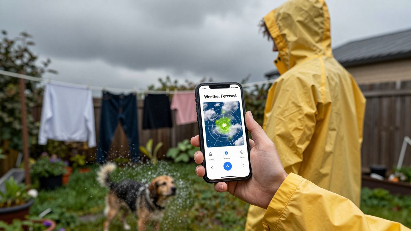
The sky has that familiar low, iron-grey ceiling. The pavement never quite dries, the dog smells permanently damp, and your washing line is a museum of half-dry jeans. Somewhere between the third named storm of the season and yet another yellow warning from the Met Office, you glance at a weather map on your phone and see it: a strip of deep orange and red spreading across the North Atlantic, just off our shores.
That’s not sunset. It’s sea-surface temperature – and in the past couple of years, those colours have been off the charts. Scientists are now quietly alarmed by how warm the North Atlantic has become, and not just for the sake of fish. For a small, weather-obsessed island parked on its eastern edge, it could mean one very down-to-earth thing in the coming decades: winters that are milder, but noticeably wetter.
You’re not imagining it. The science is catching up with what your soggy socks already know.
What scientists are seeing in the North Atlantic
We’re used to talking about global warming in terms of air temperatures, but most of the extra heat our planet is trapping has gone into the oceans. The North Atlantic has been no exception – yet since 2023, something unusual has happened on top of that long, slow trend. Sea-surface temperatures there have surged to record highs, months in a row, across huge areas.
Climatologists call this a “marine heatwave”: a prolonged period when the ocean is significantly warmer than its typical seasonal average. In parts of the North Atlantic, the water has been running several degrees hotter than expected. That might sound trivial, like turning the bath tap a notch, but on ocean scales it’s enormous. You’re talking about billions of tonnes of extra-warm water sitting just west of us.
Why now? There’s no single smoking gun, but a stack of suspects:
- Decades of greenhouse gas emissions steadily warming the sea.
- Natural climate patterns, like El Niño, nudging weather systems.
- Cleaner shipping fuel regulations reducing reflective sulphur pollution over the ocean, allowing more sunlight to be absorbed.
- Shifts in Saharan dust and wind patterns that usually help keep the surface a little cooler.
Scientists are still unpacking the exact recipe, and not every spike will repeat. But the underlying message is clear: the North Atlantic is running hotter, and that’s not a one-off blip. For Britain, that matters because the Atlantic is our weather engine.
How a hot ocean can soak a small island
Stand on a Cornish cliff in January and you can feel it in your face: weather here doesn’t appear from nowhere, it comes in off the sea. The prevailing westerly winds drag in air that has just passed over hundreds of miles of Atlantic water. Warm that water up, and you change what that air is capable of carrying.
Warmer seas do three big things to our winter weather:
They pump more moisture into the atmosphere.
Think of the ocean as a giant, slow-boiling kettle. The warmer the surface, the more water vapour it sends upwards. Every extra degree of warming lets the air hold around 7% more moisture. That doesn’t guarantee rain, but when conditions are right, it means showers turn into downpours.They can juice up storms.
Autumn and winter low-pressure systems feed off temperature contrasts – between the warm ocean and the cold air above, and between tropical and polar regions. A warmer North Atlantic can act like premium fuel, helping some storms deepen faster and carry more rain as they march towards us.They can help steer the jet stream.
The jet stream – that fast ribbon of air high above the Atlantic – acts like a conveyor belt for storms. Shifts in ocean heat can subtly drag it north or south, or make it wavier and more prone to “sticking”. When it parks itself over or just south of the UK, that’s when you get those relentless weeks of wind, rain and named storms.
Put together, this means a hotter North Atlantic doesn’t just raise sea temperatures for swimmers in July. It tilts the odds towards:
- More very wet days in autumn and winter.
- Rain arriving in heavier bursts, rather than as endless drizzle.
- A greater chance of back-to-back storm systems.
Not every winter will behave the same – British weather remains gloriously chaotic – but the baseline is edging towards “milder, wetter, and occasionally wilder”.
Why this spike is different – and why it worries forecasters
We have always had warmer and cooler phases in the North Atlantic; they’re part of the climate’s natural rhythms. What’s different now is that those swings are happening on top of a steadily rising floor. Imagine reusing a bathtub, but each time you start with a bit more water already in it. It takes less to tip it over.
Climate models have been fairly consistent on one thing: as greenhouse gases rise, north-west Europe is likely to see:
- Slightly milder average winters.
- More winter rainfall overall, especially in the west.
- A higher risk of intense rainfall events.
The recent North Atlantic heatwave looks very much like a preview of what a “new normal” might feel like if warming continues. It has also reignited questions about the Atlantic’s great conveyor-belt circulation (the AMOC), sometimes dramatised as the “Gulf Stream shutdown”. Scientists are cautious here: there’s evidence the AMOC is weakening over decades, but a sudden disaster-movie collapse is still considered unlikely in the near term.
The more immediate concern is simpler and closer to home: water where we don’t want it – in fields, on roads, in living rooms.
Hydrologists are already seeing a pattern: saturated ground in winter, rivers responding faster to heavy rain, and flood defences coming under pressure more often. Slide an extra-warm Atlantic into that picture and the odds of repeated flooding, landslips and infrastructure disruption start creeping up.
Let’s be honest: nobody experiences “climate change” as a graph. You experience it as the fourth time in a month you’re rearranging work because the trains are flooded.
What it could mean for your winters
You don’t need a degree in atmospheric physics to feel the difference; you’ll meet it on the school run, the commute, the walk to the shops. If the North Atlantic stays unusually warm in the coming years, and the broader warming trend continues, you’re likely to notice:
More rain, less frost.
Fewer crisp, icy mornings; more days that are a few degrees above freezing but relentlessly damp. The kind of weather where nothing quite dries and the dog towel becomes a permanent fixture by the door.Heavier bursts when it does rain.
That passing shower that used to be annoying now turns the street into a shallow stream. Drains struggle, small brooks swell quickly, and “surface water flooding” becomes a more familiar phrase in local news.Storm seasons that feel busier.
Not every year, but in some winters you’ll see a rapid-fire sequence of named storms, with short lulls in between. Each one brings strong winds and heavy rain to already soaked ground, nudging up the risk of trees down, power cuts, and localised floods.Higher flood risk in some areas.
Especially in western and northern parts of the UK, and low-lying river catchments. Places that have “just about coped” in previous decades may start to see flood warnings more often, simply because the typical winter downpour is packing more water.A new kind of winter energy bill maths.
Milder air can ease heating demand, but dampness can increase mould, condensation and the need for dehumidifiers or better ventilation. Old, leaky homes may feel clammy rather than cold, which isn’t great news for respiratory health.
None of this is destiny. Year-to-year variations, blocking highs, sudden stratospheric warmings and all the other quirks of the atmosphere will still throw up dry, cold or even snowy spells. But think in decades, not days, and the direction of travel is towards wetter winters as the price of a warmer Atlantic and planet.
What you can actually do about it
You can’t single‑handedly cool the North Atlantic, and you don’t control the jet stream. But there are two layers you can influence: how exposed you personally are to wetter winters, and how much more warming we collectively lock in.
On the close-to-home front, small, practical steps add up:
Know your water.
Check your home’s flood risk on official maps, not just by memory. Find out whether you’re in a surface water, river or coastal risk zone – or surprisingly, all three.Audit the gutters and ground.
Clear gutters and drains, check where water runs off your roof and patio, and make sure it has somewhere sensible to go. A blocked gully now is a mini indoor waterfall later.Think about storage and electrics.
Keep valuables and critical electrics (like routers, extension leads and power strips) off the floor if you’re in a basement or ground floor at risk. A few bricks under a bookcase can be the difference between inconvenience and heartbreak.Support local drainage fixes.
Those boring consultations about SUDS, soakaways and tree planting? They’re the civic equivalent of moving your milk off the fridge door. Unflashy, but they buy you resilience.
On the bigger picture, the logic is brutally simple: every tenth of a degree of global warming avoided makes extremes less extreme. Cutting emissions quickly – at national, local and personal levels – doesn’t cancel the changes already in the pipeline, but it does stop them escalating.
You don’t have to do everything. You do have a stake in whether your grandchildren see this winter as “one of the wet ones” or “one of the relatively dry ones from before it really kicked off”.
A small island learning to live with a hotter sea
There’s something quietly humbling about realising that what happens hundreds of miles out, over deep Atlantic water, can decide whether your Sunday football match is cancelled. Britain has always been at the mercy of the ocean; we tell that story in shipwrecks and fishing lore. Now the story is being rewritten in flood alerts and train cancellations.
The North Atlantic is warming in a way that’s hard to ignore, and our winters are already starting to answer back. Not with Hollywood disaster, but with a slow shift in what “normal” feels like: more damp, more deluge, more days where you wring out your sleeves.
Once you see the link – that orange smear on the sea-surface map quietly feeding the clouds above your street – it’s hard to unsee it. The choice ahead isn’t between wet or not wet, storm or no storm. It’s between a future where we simply endure whatever rolls in off a hotter ocean, and one where we adapt smartly and cut the heat at its source, so that our children inherit winters that are manageable, not overwhelming.
| Point clé | Détail | Intérêt pour le lecteur |
|---|---|---|
| Warm Atlantic, wetter winters | Hotter sea surfaces feed more moisture and stronger storms | Explains why your winters feel milder but soggier |
| Heavy rain, not just more rain | Moist air turns showers into intense downpours | Helps you understand rising flood and disruption risks |
| Adapt and cut emissions | Local resilience plus climate action both matter | Shows where your choices still make a real difference |
FAQ:
- Does a warmer North Atlantic mean it will stop snowing in Britain?
No. Cold snaps, snow events and even severe freezes can still happen when the right air masses line up. But on average, milder maritime air and wetter conditions mean snow is likely to be less frequent at low levels and less long‑lived, especially in southern and western areas.- Will every winter now be stormy and wet?
Not every year. Natural variability can still give us relatively dry or calm winters. However, as the Atlantic and the planet warm, the long‑term trend shifts towards more rainfall and a higher chance that, when it is wet, it’s very wet.- Is the Gulf Stream about to shut down and plunge us into an ice age?
Current evidence suggests the Atlantic circulation is weakening, but a sudden collapse in the next few decades is still considered unlikely. The more pressing issue is the gradual warming we’re already locked into, which tends to make UK winters milder and wetter rather than colder.- How soon will we feel the impact of this unusual Atlantic warming?
In some ways, you already are: recent winters with repeated storms and heavy rainfall fit the pattern models have projected. The exact influence varies year by year, but the background risk of wetter winters is rising now, not in some distant future.- What’s the single most useful thing I can do personally?
Split your effort: one practical step to reduce your own exposure to flooding or damp (like checking drains, storage and local flood plans), and one step that cuts emissions (such as changing how you travel, heat your home or vote). Both help decide how wet, and how manageable, future winters will be.


Comments (0)
No comments yet. Be the first to comment!
Leave a Comment